Prepared by Nyoman Bagiarta — October 1992, Revised November 2014
I. Vision
Water is essential for survival, and many cultures and civilizations honour bodies of water. In Bali, water is an essential element of ritual and ceremony, drinking and household use and cultivating crops, especially rice. This paper explores the urgent necessity of conserving water sources in Tamblingan for religious, domestic and agricultural purposes.
II. Historical Background of Dalem Tablingan Kingdom
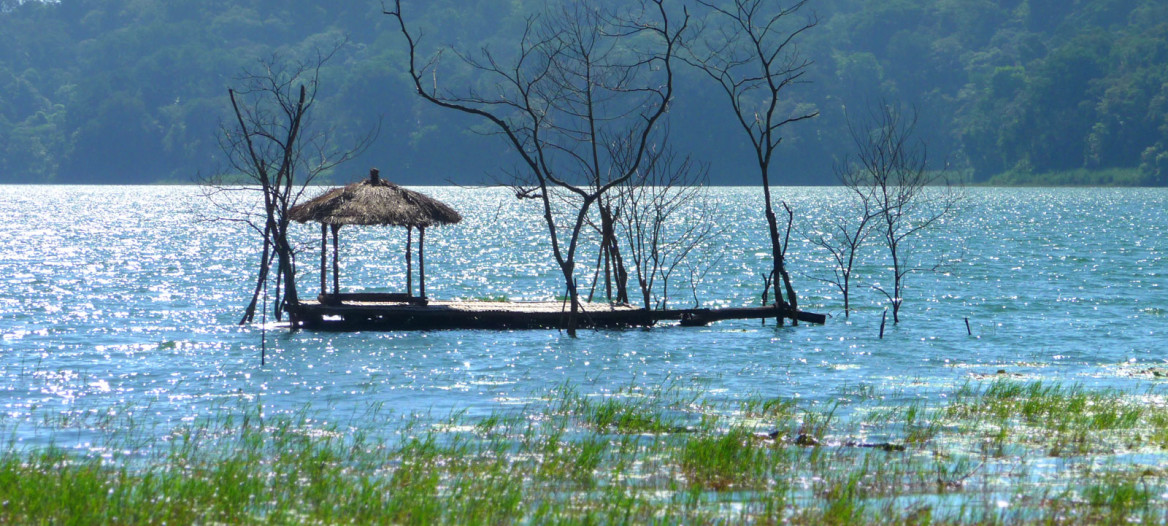
Tamblingan is an area centered on Lake Tamblingan with a number of dependant villages. The name probably derives from the Balinese word Tambe Ilang meaning loss of power. Historically Tamblingan Lake and the surrounding area are important to the Balinese, particularly for people living in the Northern and South Western part of the island. The Tamblingan area was known as a cultural and spiritual centre since the rule of King Ugrasena (915–936 AD) and Sri Paduka Bhatari Sri Parameswara (1398 AD). The lake is located about 5 km from Munduk village. Its size is about 115 Ha, depth 24 m, and its capacity to store water is about 27 million cubic meters from a forest catchment area of 4,670 Ha.
A bronze inscription, called Gobleg Pura Batur A from the 10th Century AD, mentioned Ugrasena as the King who ruled the area of Wisnawa, Bhaskara and Tana. Another, old Gobleg Pura Batur B, mentions villages or settlements under the control of Tamblingan. These are Hunusan (now called Unusan) which developed as the villages Gobleg and Tengah Mel (now called Tengemel) and Batu Mejajah which have moved down into what is now Munduk Village. Other settlements, satellites of the Tamblingan Kingdom, were called Kedu, Pangi and Esong, now called Gesing Village. The rice growing area was owned by the royal family of Tamblingan Kingdom in the Western part called Umajero. Those four villages are called custom villages. The people have lived there from ancient times until the present and have been using holy water from two sacred springs called Bulakan (in Gobleg Village) for all kinds of ritual ceremonies (Wisnuism Secte).
The last Hindu Kingdom of East Java called Majapahit under the great Prime Minister Gajah Mada sent an expedition to prepare for the invasion of Bali in 1343. It was reported that they passed through a number of villages such as Kayuputih, Banyuatis, Gesing and Yeh Song (now called Esong), Munduk and Tamblingan. They settled at Tamblingan before moving on to occupy Bali. A number of ancient ceramic and stone artifacts were found by a fisherman named Pan Niki in 1987 in Kayuputih and Tigawasa villages. An ancient stone Linggam-Yoni and a number of old stone wash basins which were normally used for soaking by the smiths were also found in the area. These discoveries indicate that Tamblingan and the surrounding area have existed as a cultural centre for around 2,000 years.
Since Buleleng Kingdom fell under Dutch control in 1894, the four villages of Gobleg, Munduk, Gesing and Umejero have been influenced by Western culture. This is evident today in the remaining Dutch architecture and the commodity plantations of coffee, vanilla, cloves and cocoa. Tamblingan remains as a centre of cultural and spiritual beliefs to this day. On a fairly regular basis, believers in old Hindu concepts undertake their ritual ceremonies starting at the river Mendaung (Gobleg) and river Cangkup (between Munduk and Gesing Village) and Munduk, moving to Tamblingan Lake and then for a final cleansing to the sea temple at Labuhan Aji near Lovina. Comparing this to the concept of Tri Angga Sarira, we can consider Tamblingan and the Mount Lesong region as the head, the four villages of Gobleg, Gesing, Umejero and Munduk lower down as the middle of the body, and the beach/seas as the lowest part of the body — to be cleansed before humans return to the creator.
From the current scientific point of view, the fragile structure of the mountainous area (the head or nucleus) needs to be protected from potential damage caused by erosion and landslides. This can only be achieved by maintaining and protecting the natural biodiversity of the area. Already large areas of tropical forest in Bali have been destroyed, and open areas are more prone to natural disasters. The source of water for drinking and agriculture arising in the mountains is also cause of concern. These points must be borne in mind along with policies of sustainability when considering any development in Bali.
In conclusion it is evident that many essential resources for a large area of Bali originate in the Tamblingan area. It supplies water, energy and life in the area and therefore must be protected and maintained to guarantee our future livelihood and happiness. This philosophy is in accordance with the Balinese Tri Hita Karana and Tri Angga Sarira concepts.
III. A Scheme to Preserve Threatened Ecology and Culture
It has been explained that from a spiritual point of view Tamblingan is a much respected holy area. It also has a very important ecological function as a sanctuary for the area. It is a source of drinking water and for irrigation of the land which supports the people in the area. Therefore Tamblingan is very important in three ways:
- As the water supply
The waterfall at Munduk is the source of water for three villages to which it is piped. The water from the lake is essential for agricultural irrigation (e.g. to supply the necessary flooding of the paddy fields), and also supplies household water. - As a religious centre
Tamblingan is a very respected holy area from the spiritual point of view. There are 12 centres of spiritual importance which have been in continuous use by the local people, especially those who still practise the Gobleg ritual (Siva Muka Bulakan followers), for many years. - As an ecological sanctuary
The area contains a wide variety of flora and fauna and up until now their natural resources have not been impaired by human activities, so the ecological balance has been maintained. However this balance is a fragile one and could very easily be disrupted by activities such as uncontrolled tourism.
Argument
It is important that the delicate balance between nature and human activities which at present exists in the area should be maintained so that the natural resources of the area are not destroyed. This is important not only to preserve the beauty of the area itself, but also to preserve the way of life and cultural heritage of the people who live there. The unspoiled quality of the area means that it is very attractive to visitors — but there is a real danger that uncontrolled tourism will not only harm the way of life of the inhabitants and their quality of life, but will also destroy the very qualities which lead visitors to come to the area. It is important to maintain the balance between the spiritual and physical needs of all people who live in the Tamblingan area.
The records from the Forestry Department of the district show that the area comprises 12,000 hectares of protected wild forest, 270 hectares of preserved forest and 400 hectares set aside for tourism. There are four villages which are totally dependent on the Tamblingan Lake for their water supply: Gobleg, Munduk, Gesing and Umejero.
The agriculture in the area has diversified in the last century from the original staple crop of rice. It now includes coffee (both Robusta and Arabica varieties), cloves which were introduced by the Dutch about 40 years ago, vanilla, fruit and flowers. The economy is still a rural one with no industry.
The four villages listed above are totally and directly dependent on the lake for their water supply. Other villages in the district (Busungbiu, Seririt, Banjar and Gerogak) with a further population of over 200,000 people, are totally dependent on the ecology around the lake and wild forest surrounding it. Development of the area should take into account the need to preserve the ecological balance, which means that the use of natural resources must be carefully controlled — for example, motor boats should not be allowed on the lake.
Anything which harms Tamblingan as a water source will not only upset the ecology but undue commercialisation will also harm the spiritual centre, which would have an adverse effect on the spiritual and cultural lives of the people.
Using the Hindu concept of Bali, the basin/crater could be equated to Yoni and Mount Lesung as Linggam; both can be called the Power of Siwa. The Linggam-Yoni concept equates with the concept of reproduction. The upper part of the area (Tamblingan, Mount Lesung and the surrounding forest) is called Utama (Prime area), the Catur Desa (Munduk, Gobleg, Gesing, Umejero) area is called Madya (middle area) — for peaceful living, social and economic activities — and the lower part at Umeanyar, Lovina and Labuhan Aji beach and the sea is called Nista, for recycling and cleansing activities.
The importance of these functions is obvious for ensuring the continuance of the people's lifestyle and livelihood. As we can see from the ecological viewpoint, the area from Tamblingan down to Seririt and Banjar district forms a solid biosphere area which needs continuous protection. Therefore from the viewpoint of both Tri Angga and the solid biosphere concept, the Tamblingan area must be protected strictly — as long as we believe that human civilisation has to be passed on from generation to generation. It is essential that this biosphere area should be promoted as a sanctuary site to be called Tamblingan Sanctuary.
Conclusion
The whole of the Tamblingan area down to Seririt and Banjar district forms a solid biosphere which needs continuous protection. This can only be achieved by establishing a sanctuary which will preserve the lakes as a source of water and control the development of the areas to preserve the ecology and the lifestyle and culture of the people.